
If Birds Could Draw
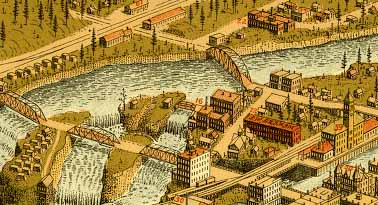
At the turn of the twentieth century hand-drawn panoramic maps were an amazing way for people to get a view of their world they could never experience in reality. These maps presented towns and cities from a unique oblique (cool word combination, huh) angle.
The library of congress has a bunch of them online. You can look for your city here.
Here are a few that Top Men enjoyed...
Bangor, Maine, 1875
Santa Fe, New Mexico, 1882
Asheville, North Carolina, 1891
Spokane Washington, 1905
----
Previous related Wohba links:
Aerial Photos before Airplanes
posted by topmen at 12:10 PM
![]()
![]()


0 Comments:
Post a Comment
<< Home